Mexico City Benito Juarez International Airport (MEX)
Driving Directions / Travel by Car
(Mexico City, Mexico)
Standing on the eastern side of the city, Mexico City International Airport (MEX) is easy to find and reach, with the facility being connected by a number of fast roads and highways.
The airport can be reached in around 20 minutes and is signposted locally as the 'Aeropuerto Internacional de la Ciudad de México' or the 'Aeropuerto Internacional Benito Juárez'.
Directions to Mexico City International Airport (MEX) from downtown:
- The airport has good connections to Mexico City's highway network
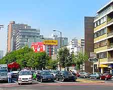
- Travel along the Paseo de la Reforma and head in an easterly direction
- Turn right into the Avenue Rio Consulado and continue in an easterly direction
- Turn right into the Circuito Interior Highway and continue in an easterly direction
- Follow the airport signposts, and then turn into Mexico City Airport
Directions to Mexico City International Airport (MEX) from the north (Teotihuacan)
- Travel along the Autopista Mexico and head in a southerly direction
- Exit the highway at Avenida Insurgentes
- Turn left into the Circuito Interior Highway and continue in an easterly direction
- Follow the airport signposts, and then turn into Mexico City Airport
Directions to Mexico City International Airport (MEX) from the south (Cuernavaca)
- Travel along the Highway 95 and head in a northerly direction
- Turn right into the Circuito Interior Highway and continue in an easterly direction
- Follow the airport signposts, and then turn into Mexico City Airport
